

UPDATE: Due to the storm, the Council Rock School District announced a synchronous, flexible instructional day for Thursday.
Original Story:
A mix of winter weather that is expected to cause problems on the roads will begin Wednesday evening, according to the latest forecast from the National Weather Service’s regional office.
The area is set to see a combination of snow, sleet, freezing rain, and rain into Thursday, causing concerns about hazardous travel conditions.
The regional forecast office describes the upcoming weather as a “messy mixed bag of wintry precipitation.”
A Winter Weather Advisory has been issued for the area from Wednesday morning through late Thursday morning.
The storm is expected to move into the region Wednesday afternoon.
The first phase of the storm could lay as much as 2 inches of snow in Bucks County and Hunterdon County through Wednesday night. The snowfall is expected to transition to a wintry mix overnight, leading to possible light ice accumulation.
After Thursday morning commute, the precipitation is likely to turn entirely to rain, according to the forecast.
Forecasters warn that the type and amount of precipitation are still uncertain, but the impact on road conditions will likely be significant.
“Exact precipitation type and forecast totals remain uncertain,” forecasters said. Regardless, the main takeaway remains the same: wintry precipitation will lead to icy and slippery conditions Wednesday night to Thursday morning.”
The expected snow and sleet are predicted to be heavy and wet, according to the National Weather Service.
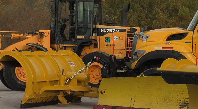
Municipal and state road crews began pretreating roadways Tuesday ahead of the storm, but PennDOT officials warn that icy spots may still persist.
“Roads that look wet may actually be icy, and extra caution is needed when approaching bridges and highway ramps where ice can form,” according to a PennDOT spokesperson.
Looking ahead, forecasters said more wintry systems are possible Saturday night followed by a potential system next Tuesday into Wednesday.
Below is the upcoming forecast from the National Weather Service:
Monday: Cloudy, with a high near 34. North wind around 5 mph becoming calm in the afternoon.
Monday Night: A chance of snow before 1am, then snow likely, possibly mixed with freezing rain between 1am and 4am, then snow and sleet after 4am. Low around 27. Calm wind becoming southeast around 5 mph after midnight. Chance of precipitation is 80%. New ice accumulation of less than a 0.1 of an inch possible. New snow and sleet accumulation of less than one inch possible.
Thursday: Rain, snow, freezing rain, and sleet, becoming all rain after 10am. High near 41. East wind around 5 mph becoming southwest in the afternoon. Chance of precipitation is 100%. New ice accumulation of less than a 0.1 of an inch possible. New snow and sleet accumulation of less than a half inch possible.
Thursday Night: Mostly cloudy, with a low around 34. West wind 5 to 10 mph.
Friday: Sunny, with a high near 40. West wind around 15 mph, with gusts as high as 30 mph.
Friday Night: Partly cloudy, with a low around 23.
Saturday: A chance of snow after 1pm. Mostly cloudy, with a high near 37. Chance of precipitation is 50%.
Saturday Night: Rain, snow, and freezing rain before 1am, then rain or freezing rain. Low around 29. Chance of precipitation is 100%.
Sunday: Partly sunny, with a high near 45.
Sunday Night: Partly cloudy, with a low around 23.
Monday: Mostly sunny, with a high near 36.
Monday Night: Mostly cloudy, with a low around 23.
Advertisement

Convenient Legal Access to High Quality Cannabis Just A Few Minutes Away!