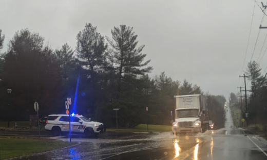
Emergency officials and weather forecasters are issuing stark warnings for Lower Bucks County as a severe storm is poised to bring heavy rainfall and expected flooding from Tuesday through Wednesday.
The National Weather Service has placed the area under a Flood Watch and Coastal Flood Warning in anticipation of the storm, which is expected to move in Tuesday afternoon.
Forecasters have identified the area as being at a “significant” risk for substantial impacts due to rain, wind, and flooding.
According to the National Weather Service’s regional office, the storm could unleash 1 to 3 inches of rain, with the possibility of up to 4 inches in certain areas. The heaviest downpours are expected on Tuesday night.
Areas along the Delaware River are predicted to see rising water levels and potential flooding.
The risk of river flooding is expected to persist through Wednesday and potentially beyond.
The Neshaminy Creek is predicted to overflow its banks in Bucks County.
Ponding from heavy rain could happen in low-lying area.
Adding to the concerns are forecasts of strong to damaging south to southeast winds from Tuesday evening into the night.
Strong winds raise the chances of tree damage and power outages, with gusts reaching as high as 55 mph, forecasters said.
“Here’s the catch – the ground is already saturated, and with melting snow, there’s a risk of potential flooding. With these conditions, there’s also a chance of power outages for an extended period,” the Bucks County Emergency Management Agency said.
Officials anticipate that the Neshaminy Creek will hit moderate flood stage early Wednesday morning.
In Bristol Borough, flooding along the Delaware River is anticipated throughout Wednesday.
Upper Makefield Township, New Hope Borough, and the City of Lambertville in Hunterdon County are also preparing for rising river levels, though the river is expected to remain below flood stage.
The flooding would be the second event in the Newtown area and Levittown area since the start of December.
Upper Makefield Township police have issued a warning ahead of potential flooding given the already saturated ground.
Should the forecasted weather patterns persist, authorities anticipate flooding in familiar locations within the township. The specific areas expected to be affected include:
- Eagle Road, north of Stoneybrook Road
- Brownsburg Road East, north of Stoneybrook Road
- Stoneybrook Road at the bridge situated between Shannon Road and Slack Road
- River Road, stretching between Jonathan Way and Francisco’s on the River
PennDOT Secretary Mike Carroll, along with officials from the Pennsylvania Emergency Management Agency (PEMA) and the Pennsylvania Turnpike Commission, are advising against unnecessary travel during the storm.
“This will be a challenging event with rapidly changing conditions, and we ask the public to avoid unnecessary travel if possible. If you must travel, please exercise caution, check 511PA.com for the latest conditions, and give our crews space to safely and effectively respond to the storm,” said Carroll.
Motorists are being advised not to attempt crossing roads submerged in water, as even shallow, fast-flowing water can sweep a vehicle away.
PEMA Director Randy Padfield highlighted the storm’s potential for significant flooding in parts of eastern Pennsylvania. He stressed the importance of being weather aware and having evacuation plans ready.
Authorities remind residents to never drive around barricades or signs on closed roads, adhering to the mantra: “Turn Around, Don’t Drown.”


